Forgotten 1876 Map Reveals the Truth About Custer's Last Stand Says Author Robert Nightengale

Faribault, MN, February 12, 2016 (Newswire.com) - An appeal has been made to the U.S. Army to correct the map used at the only official inquiry into Custer’s Last Stand. “The map used at the 1879 Reno Court of Inquiry was a poor reproduction of the original 1876 map,” says author Robert Nightengale of Faribault, Minnesota. “The original map was drawn on the battlefield two days after the battle by Chief Engineering Officer Lieutenant Edward Maguire, using a prismatic compass and an odometer cart, while the trails were fresh, survivors could be interviewed, and 7th Cavalry soldiers were being buried where they fell. This map must be considered accurate, but apparently remained with the Chief Engineer’s Report of 1876 and was not produced at the Reno Court of Inquiry in 1879.”
The appeal to the Army lists several discrepancies between the two maps and on the application it says, “I believe the record to be in error or unjust for the following reasons: The printed map presented at the Reno Court of Inquiry as ‘Exhibit Two’: 1. Omitted a hidden Indian camp in the woods near the river which indicates a planned ambush. 2. About 500 wickyups (a shelter for up to four warriors) placed with obvious military purpose along a ravine north of the main Indian camp, has been removed. 3. A mile long row of about 500 wickyups south of the main Indian camp, is also removed. 4. One of two ravines in the Little Big Horn Valley is removed and the obvious military placement of the main Indian camp, estimated at 1800 teepees, no longer represented. The 1876 map indicates 7000 or more Indian Warriors were at the battle opposing less than 700 7th Cavalry officers, soldiers, and scouts. 1879 court of inquiry testimony stated the warriors were armed with thousands of Model 1873 Winchester repeating rifles. Numbers, weapons, terrain, and an ambush planned by the Indian leader Chief Sitting Bull, confirm the battle was a hopeless ambush for the 7th Cavalry, and the use of the 1876 map at the Reno Court of Inquiry would have completely exonerated Major Reno concerning his conduct at the battle. ”
"There will always be many mysteries concerning Custer's Last Stand and another one of these mysteries is why the 1876 map has been ignored by historians."
Robert Nightengale, Author
“This map could be considered the Holy Grail concerning the mystery of Custer’s Last Stand. Obviously, without referencing the 1876 map,” Nightengale asserts, “any story of the most famous battle in the American West is incomplete, to say the least.”
“Besides the obvious differences between the two maps, the existing maps of the battle have produced astonishing confusion,” says Nightengale. “Both the 1876 and 1879 maps, and other corroborating maps drawn in 1876, seem to indicate a significant historical site on the battlefield has been marked in the wrong location. “Deep Ravine”, a location where up to twenty-eight 7th Cavalry soldiers were killed and buried, is actually the next ravine to the north of the ravine incorrectly identified on the battlefield.”
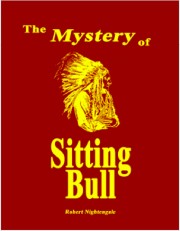
“Anyone can look at the maps, and decide for themselves,” says Nightengale. “There will always be many mysteries concerning Custer’s Last Stand and another one of these mysteries is why the 1876 map has been ignored by historians.” The maps and appeal to the Army are posted on the website of Nightengale’s new book, The Mystery of Sitting Bull. Nightengale’s also the author of Little Big Horn, which was made into the A & E documentary Betrayal at Little Big Horn, and was an episode of Pax television’s Encounters of the Unexplained and has written for Wild West magazine.
Nigthengale’s new book The Mystery of Sitting Bull is now available for purchase at http://themysteryofsittingbull.com/download.html, chapter previews are also avaiable on the website.
Media Inquiries
Robert Nightengale
sittingbullssecret@gmail.com